This is a short post about an updated version of my Green Belt Atlas, in which I've produced a map of every local authority in England that contains land designated as green belt. The original idea for this came from GIS guru Bob Barr a couple of years ago and there have been a few versions so far but this one uses the latest data and includes some new features and improvements. Here's a sample map, for York. I'm going to do a follow-up post about some of the technical stuff.
 |
| As you can see, York is 82% green belt |
I have put all 186 local authority maps in a public folder, so you can check that out if you're interested. I'll post a selection here as well. If you want to find out more about green belts and their history, I'd recommend reading John Grindrod's Outskirts.
 |
| See the whole lot here |
This version of the Atlas is, I think, an improvement on previous ones I've produced. I'll cover more of the technical details and design choices in the next blog post but for now I'm just posting the maps, and a bit of summary data.
The reason I've done this is because I'm interested in land use, land cover and suchlike, and I know others are too. This version of the Atlas uses the latest data (2016-17 green belt boundaries), which you can find on data.gov.uk, along with data for previous years.
The reason I've done this is because I'm interested in land use, land cover and suchlike, and I know others are too. This version of the Atlas uses the latest data (2016-17 green belt boundaries), which you can find on data.gov.uk, along with data for previous years.
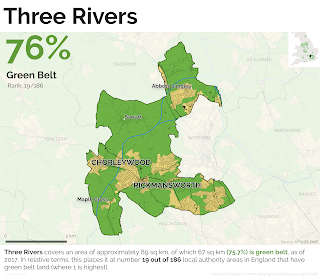
Here are a few green belt maps from the full set, just click an image to enlarge, or go to the full set if you want a high resolution download. Green areas are land designated as green belt, and I've also shown buildings, roads, railways and I've added some place names. A summary datasheet for all 186 areas can be found here as well as at the bottom of the page.
But wait! Why map this at a local authority level? Well, clearly the green belts were not designated at the individual local authority level, and that's fine. But if we're looking at the kinds of things local planning authorities have responsibility for (e.g. housing) then they do need to be aware of this kind of thing, in my opinion. The Plain English guide to the planning system (paragraph 32) is a good reference point for this:
"This means that the requirement to meet housing needs must be balanced against other important considerations, such as protecting the Green Belt or addressing climate change and flooding."
So, my view is that it's entirely logical and sensible to look at this from a local perspective.


