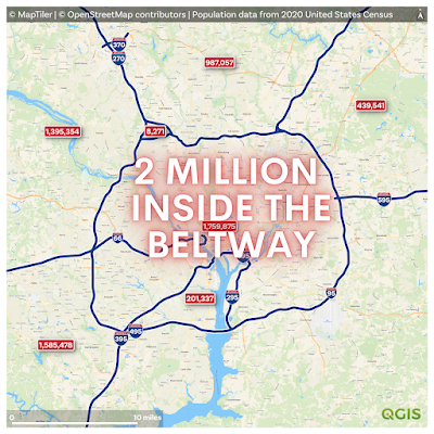
Another road-themed piece today, this time looking at US Interstates, and how many people live in between them. Why? Curiosity, plus it's a nice little data challenge using Census block population data from 2020. First off, let's start with the Beltway around Washington, D.C. - using 2020 Census data I get a total population of just under 2 million people (1,961,212), as you can see below.
 |
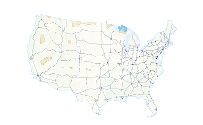
| Web map of the whole US is here |
This is what the web map looks like.
 |
| Click an area to get the population |
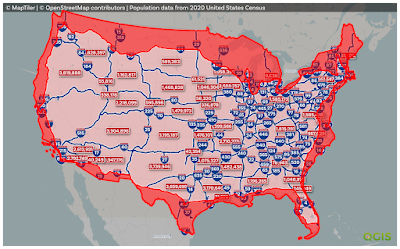
I loaded up a MapTiler streets backdrop layer in QGIS, created polygons from the the US national road network file from the Department of Transportation website (this required a lot of error checking/fixing) and then summed the population of all areas bounded by Interstates - including those in Hawaii, Alaska and Puerto Rico.
Some numbers to begin with:
- 82 million people live entirely unbounded by Interstates (25% of the total - in the big red area in the map below).
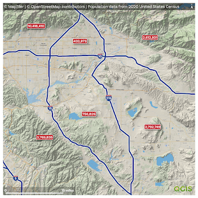
- 10.4 million people live in the most populous 'bounded by Interstates' area.
- The next most populous bounded area has 5.6 million people in it (it's in Florida, see below).
- There are 83 'bounded by Interstates' areas with more than 1 million people.
- I get 443 populated bounded areas plus one 'at large' area, unbounded by Interstates.
- There are bounded areas in Alaska, Hawaii and Puerto Rico as well as in the lower 48 states - see the web map for those.
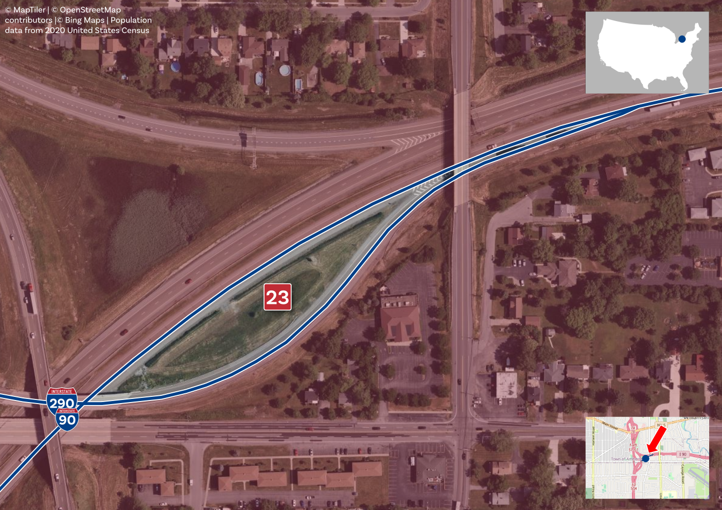
- A few areas have fewer than 100 people in them - a couple of these seem to be statistical quirks (e.g. mismatched boundaries) but many are real, including this bounded triangle in Chicago.
 |
| Such vital research |
Okay, show me the maps
Here you go, some major metro maps below. You can
zoom, pan, click as much as you want on the web map, but here are zoomed maps for some of the largest metro areas across the United States. Sometimes with terrain, sometimes not.
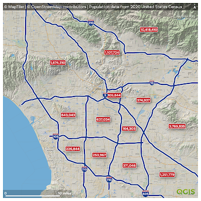 |
| Los Angeles |
 |
| New York |
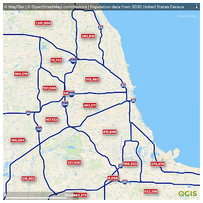 |
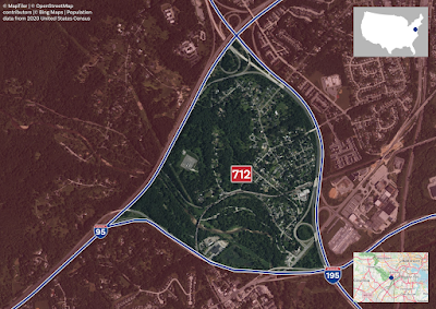
| Chicago |
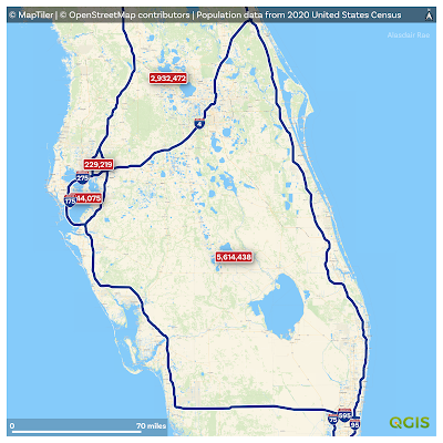 |
| Central Florida (second highest intrastate population) |
 |
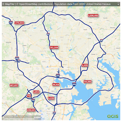
| Houston |
 |
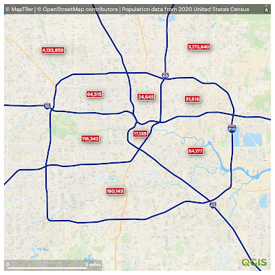
| Dallas-Fort Worth |
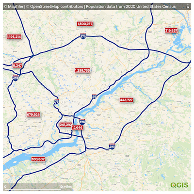 |
| Philadelphia |
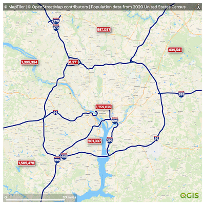 |
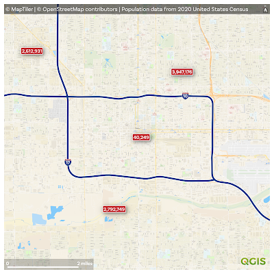
| Washington, D.C. (The Beltway) |
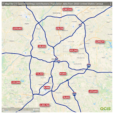 |
| Atlanta |
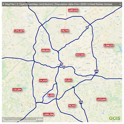 |
| Another Atlanta (different resolution) |
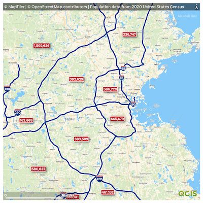 |
| Boston |
 |
| The only bounded area of Phoenix |
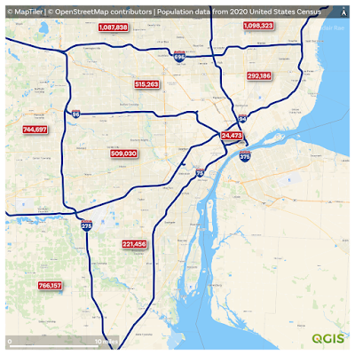 |
| Detroit |
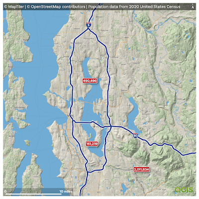 |
| Seattle |
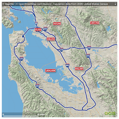 |
| San Francisco Bay Area |
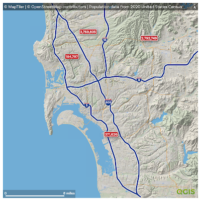 |
| San Diego |
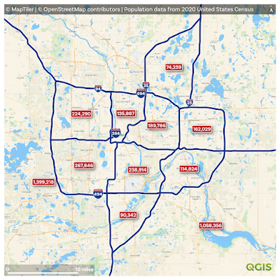 |
| Minneapolis–Saint Paul |
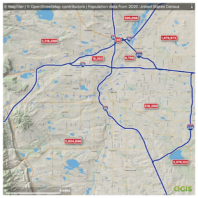 |
| Denver |
 |
| The Inland Empire (CA) |
 |
| Baltimore |
 |
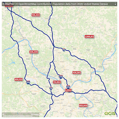
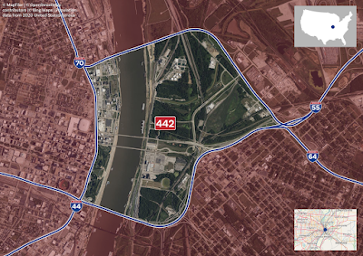
| St. Louis |
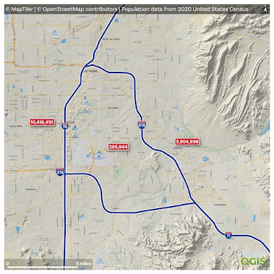 |
| Las Vegas |
 |
| Portland |
 |
| Cleveland - so much boundedness! |
 |
| Kansas City |
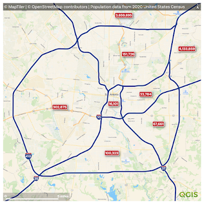 |
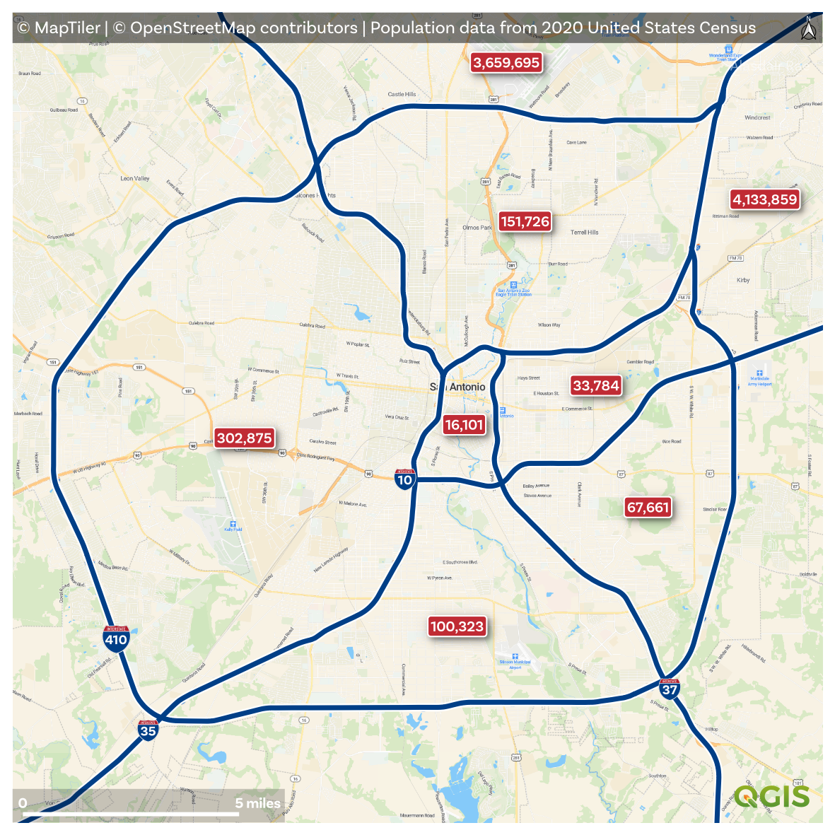
| San Antonio |
 |
| Salt Lake City |
 |
| Pittsburgh |
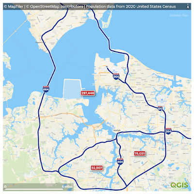 |
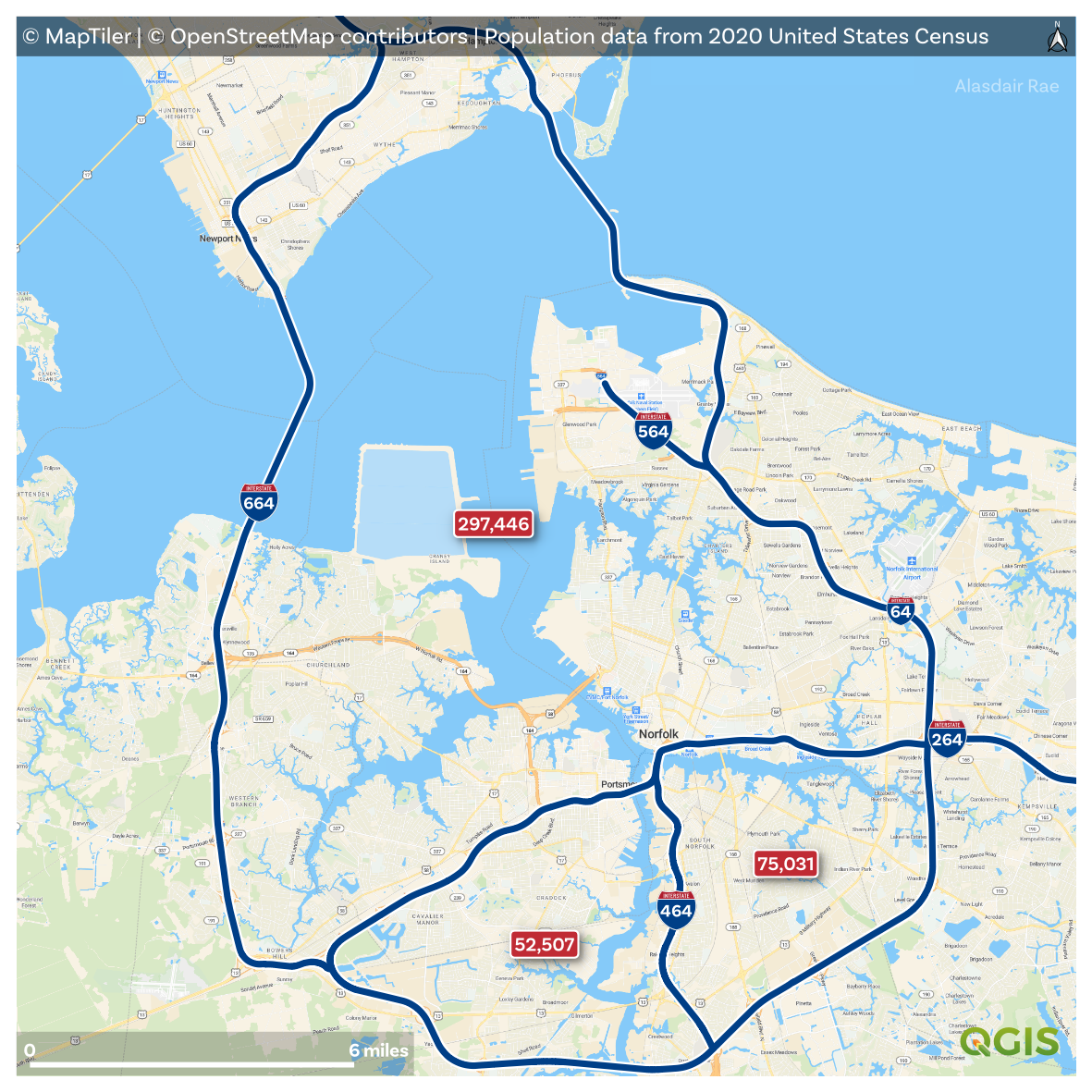
| Norfolk |
 |
| Indianapolis |
 |
| Nashville |
Where are the furthest places from an Interstate in the lower 48?
This question has been asked many times before and you can find
answers online, but basically 160 miles and higher and you're about as far as you can get. See below for a little map I made of this.
 |
| Furthest from an Interstate |
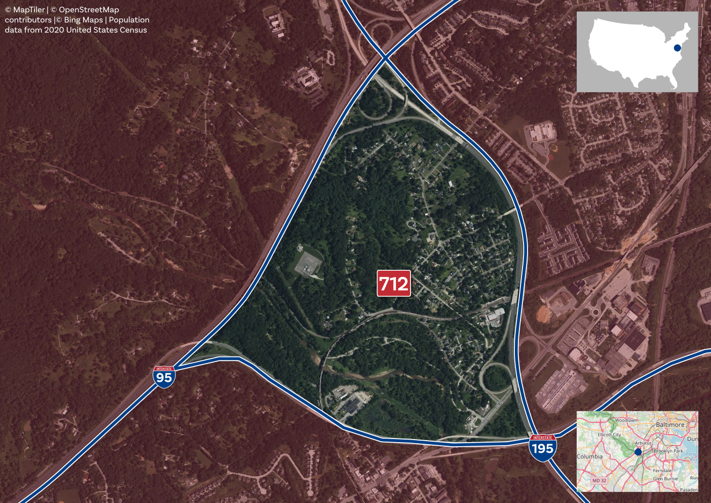
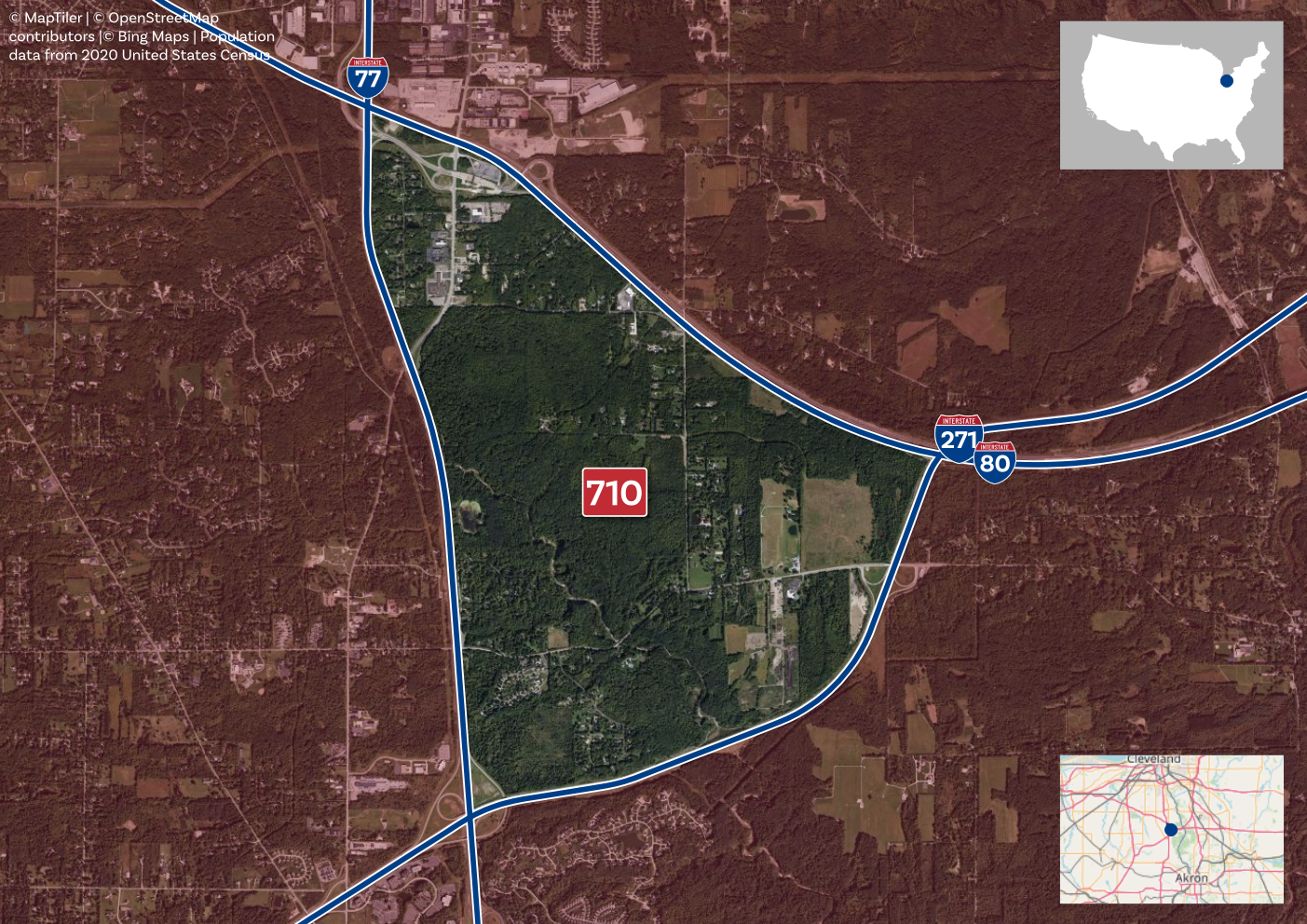
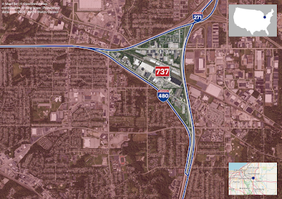
How about those tiny areas bounded by Interstates?
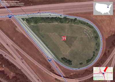
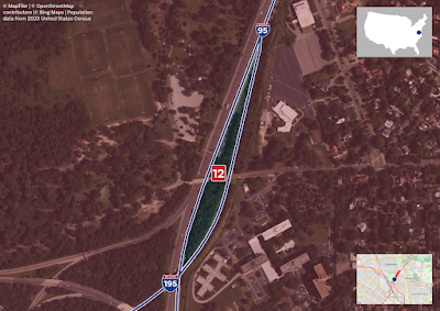
These are pretty interesting and if I had a file that included every loop of an Interstate on/off ramp then I could have done more here but as it is I had to work with what I had and I found 16 small, bounded-by-Interstates areas across the United States, including two in Alaska. Most of these seem to be correct so I've added them below, with a note where it seems to be caused by a mismatch between Census block boundaries and Interstate line locations. Usually they line up but in a few cases they don't so the population gets assigned to the wrong block - but this is very rare.
 |
| Somewhat hemmed in |
 |
| Actually pretty leafy here |
 |
| Also pretty leafy here too |
 |
| Downtown apartments in St. Louis? |
 |
| Anchorage |
 |
| West Bottom Flats, etc |
 |
| This one's mostly empty space |
 |
| Fairly unexciting here |
 |
| Another Anchorage, AK one |
 |
| Yeah, this is just an anomaly |
 |
| Another weird anomaly |
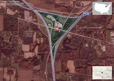 |
| I think it's just trucks and truckers here |
 |
| Yeah, no. But two Census blocks fit perfectly in here, so hmm |
Notes: like I said above, this was just a bit of map/data fun, in keeping with what I do here on my blog. But of course I also find it interesting from an urban planning and transportation point of view, particularly the small areas tightly bounded by Interstates. Sometimes Census blocks don't align perfectly with Interstates so in some cases you get tiny areas that seem like they have small populations but this isn't the case. But there are very few of these. There is one area where it looks like a truck stop area with a population of 18. I'm not sure if that's because there were 18 truckers sleeping there on Census data 2020. The
guidance from the US Census Bureau specifically mentions truckers and says that they should use their usual residential location as their address, so who knows.
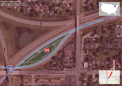
The one above, apparently with 12 people in it, is two Census blocks and the data from the US Census Bureau says there are 12 people there, so not sure what's going on. I even went back and checked
the raw data again, but it definitely says population in 2020 was 12.