There are new constituency boundaries in the UK so we made a new hex map. This means that the ones used in previous elections have been replaced by a new set. There are still 650 constituencies but they are in many cases quite different so any election boffins/mappers will need to get used to them, and their new shapes and names, pretty quickly. Take a look at this interactive map if you want to compare them (will load slowly, is best on big screen). When is the next UK general election? Well, nobody knows the date but it has to be no later than 28 January 2025. Philip Brown and I knew all this was in progress because we keep track of these things - particularly Philip - so many months ago we began the process of creating a new hex map, which you can see below. After that I say a bit more about the process of putting this together. Here's the direct link to the geo files if you want a shp, gpkg or geojson of the new hex map. Don't like hexagons? See this new video on my channel for how to change them to other shapes.
 |
| The new hexmap - web version |
 |
| Search constituencies by name |
A bit of preamable
You can make these things automatically, programmatically, algorithmically etc etc but the results will normally be very sub-optimal. Why? It's because of the difficulty of putting the hexagons together in a 'least-worst' configuration. They are all in the wrong place, but some are less wrong than others. That is, hex maps are about portraying each area with a shape covering the same area rather than geographical accuracy.
Why? Because sometimes we want to size things by population rather than land area, but this means we have to sacrifice overall shape and individual area locations. But you probably already know all about this if you're reading my blog.
Each constituency has (very roughly, and with a few notable exceptions) a fairly similar population. Here's what the Parliamentary Constituencies Act 2020 says about it.
The Act sets out a number of Rules in Schedule 2 which are relevant to the detailed development of proposals for individual constituencies. Foremost among these is Rule 2, which provides that – apart from five specified exceptions – every constituency we recommend must have an electorate (as at 2 March 2020) that is no less than 95% and no more than 105% of the ‘UK electoral quota’. The UK electoral quota for the 2023 Review is, to the nearest whole number, 73,393.
Accordingly, every recommended constituency (except the five ‘protected’ constituencies) must have an electorate as at 2 March 2020 that is no smaller than 69,724 and no larger than 77,062.
The four Boundary Commissions in the UK published their new electoral maps (after previously publishing the initial proposals) in June 2023 and then we finalised the process. There are a total of 650 constituencies, just like before, with the following number in each country of the UK.
- England (543)
- Northern Ireland (18)
- Scotland (57)
- Wales (32)
The process of making this hex map
- Meet at Dunkin Donuts many months ago to discuss doing this.
- Create blank hex grid in QGIS.
- Agree that we should start with final shape in mind.
- Agree that out of all previous UK constituency hex maps Ben Flanagan's (Esri UK) shape was the best shape, so model ours on that.
- Agree that we should generate a unique three letter code for each hex - so that (e.g.) we can label each hex within the shape and because official names often too long!
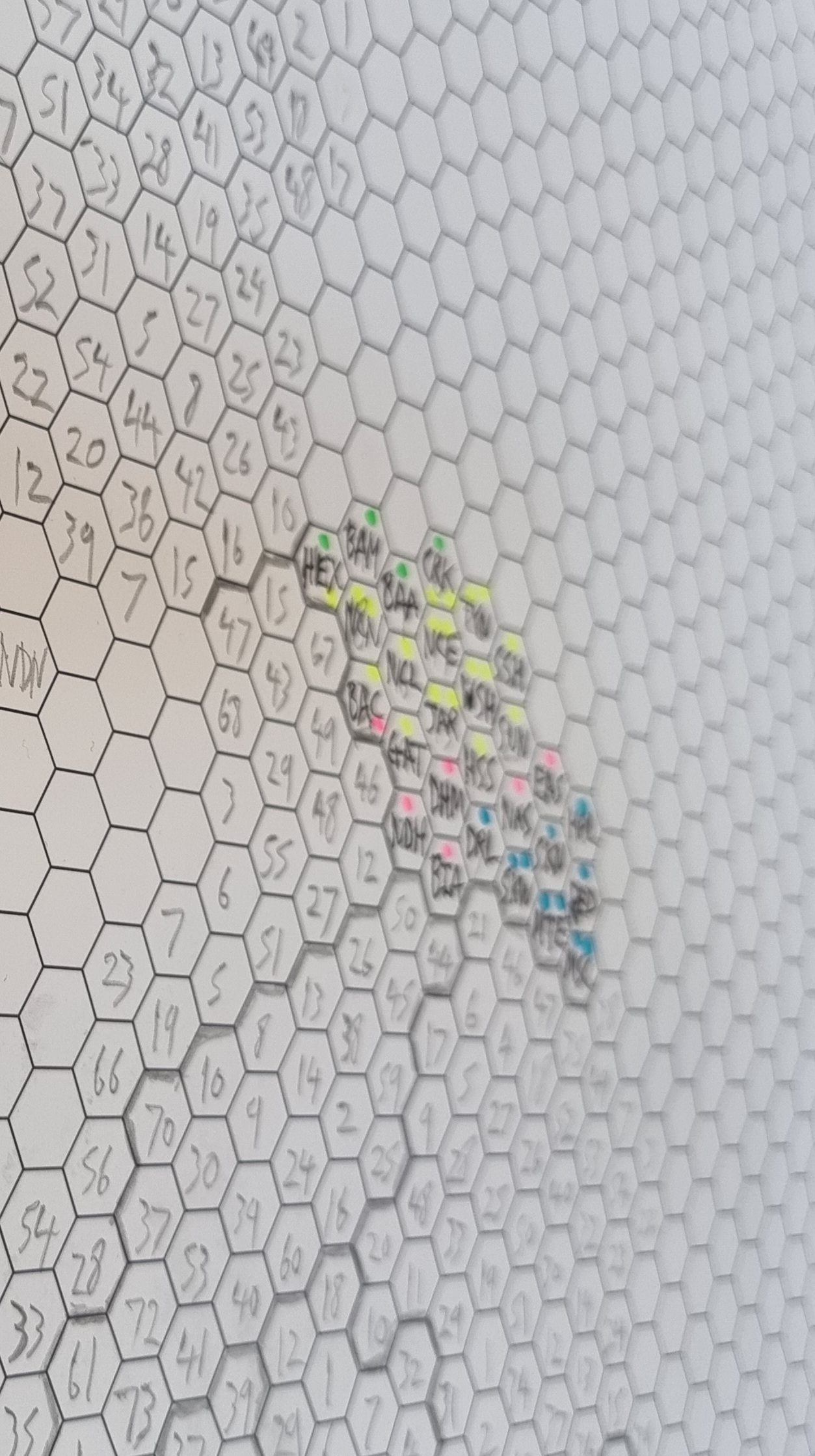
- Get loads of sheets of A2 and A3 paper printed with blank hex grids on them.
- Leave Philip to do his thing.
- Meet to discuss from time to time.
- Let Philip get on with it, region by region (England) and then UK countries.
- Monitor initial proposals from Boundary Commissions.
- Come up with final configurations on paper.
- Spend day working together on converting paper into digital.
- Revise, tweak, move a few polygons, re-shape Northern Ireland, move things around a little bit.
- Check for errors, duplicates, typos, and suchlike.
- Check again, then generate geo files for sharing (shp, gpkg, gejoson).
- Make web map available, as well as file repo.
- Add ONS area codes as soon as they become available (not sure when this will be).
Some photos and screenshots for anyone who might be interested