Wednesday, 24 May 2017
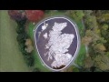
The Great Polish Map of Scotland (aka The Mapa Scotland)
›
Last week I was in Edinburgh to give a talk at the Edinburgh Earth Observatory seminar series at the University of Edinburgh, so I thought ...
Sunday, 7 May 2017
General Election 2015: the view from second place
›
In my last blog post I shared a shapefile with the current UK constituency boundaries, which included a lot of other data. One of the vari...
Sunday, 23 April 2017
Getting ready for #GE2017 - a big shapefile
›
I'm probably as unmoved as anyone else about the forthcoming General Election, but to get my head back into gear for it I thought I...
Friday, 31 March 2017
Visualising a lot
›
This post is about visualising 'a lot', because it's something I've been thinking about as I write part of a book on GIS. T...
Sunday, 26 February 2017
Train Stations of Great Britain
›
In my ongoing quest to answer the burning questions of our times, I have decided to continue my data-based boffinry by looking at a couple ...
Tuesday, 21 February 2017
The UK's Best Place to Live
›
Where is the best place to live in the UK? The answer is simple. It's in my street. But that's just my view. Ask someone else and y...
Sunday, 12 February 2017
English Green Belt Atlas, Version 3
›
In 2015, after being posed the question by geodata guru Bob Barr , I decided to attempt to calculate the percentage of land in each local ...
‹
›
Home
View web version